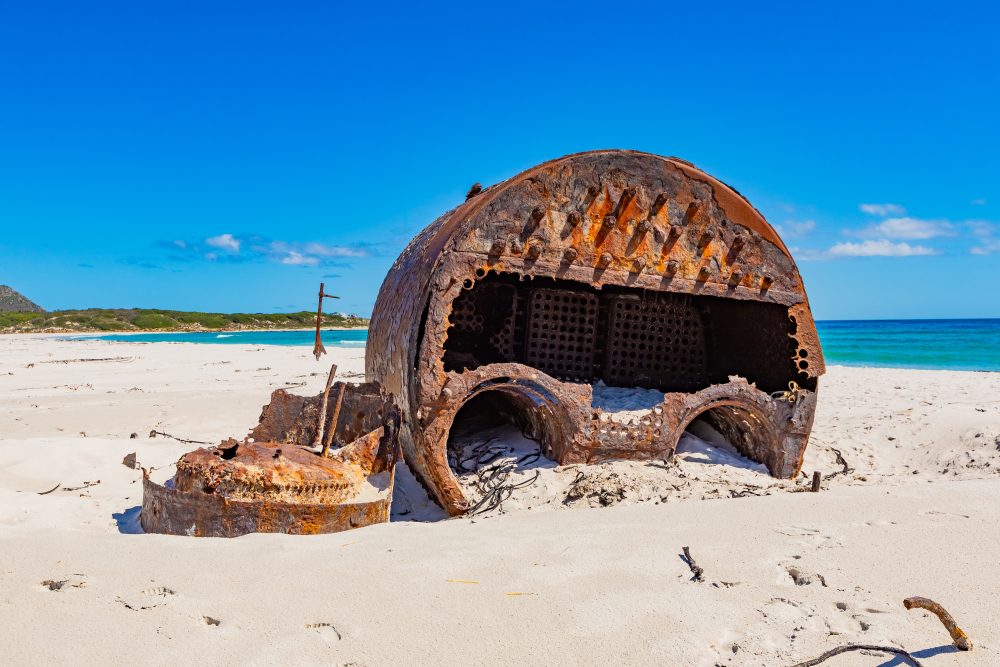
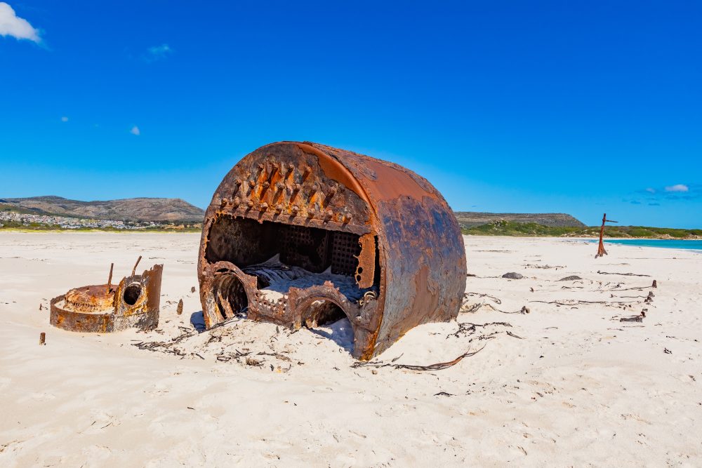
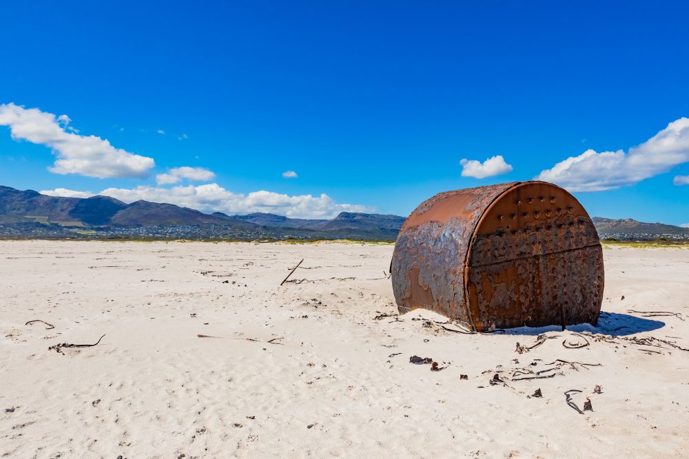
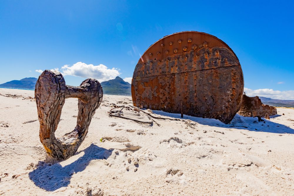
SS Kakapo Shipwreck
This schooner rigged steamship ran aground on Long Beach near Noordhoek on the Atlantic coastline on the 25th of May 1900. The SS Kakapo got wrecked particularly because of strong north-westerly gale winds of May, and this resulted in poor visibility as a result of foggy conditions and high seas. The captain saw Chapman’s Peak and thinking it was Cape Point and gave instructions to turn hard to port, maintaining full speed. It wasn’t long however when the bridge caught sight of breaking waves directly ahead. The captain, P. Nicolayson, also mistakenly identified Chapman’s Peak as the Cape Point, and this caused the ship to end up coming closer to the bridge. The captain at the time had recently been given the rank and this trip represented his first command.
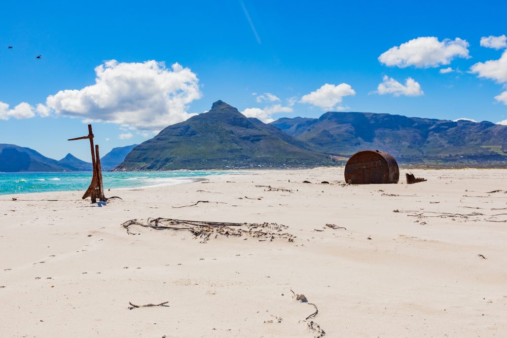
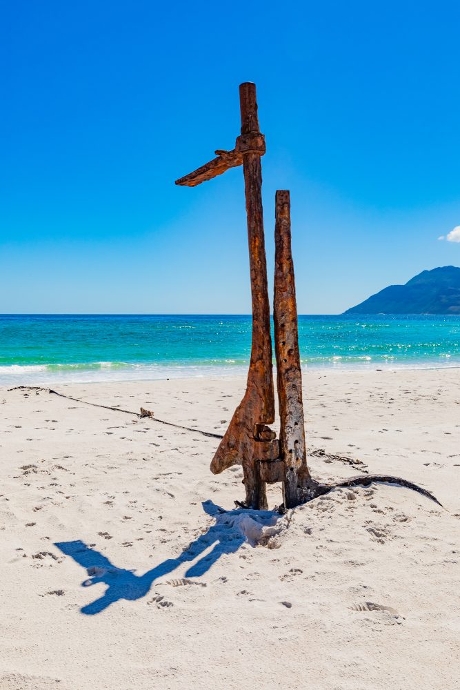
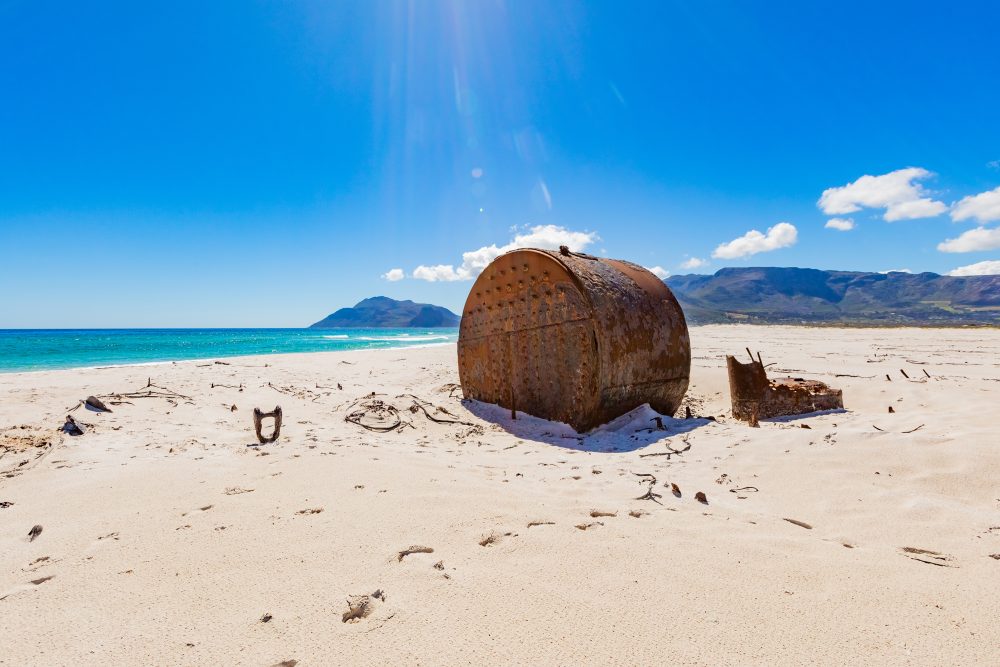
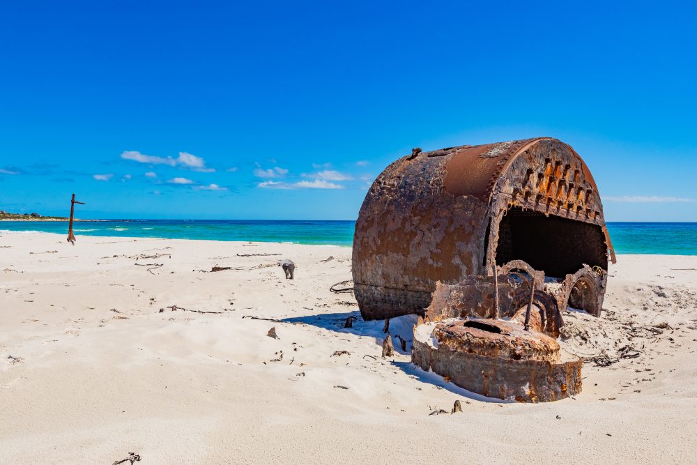
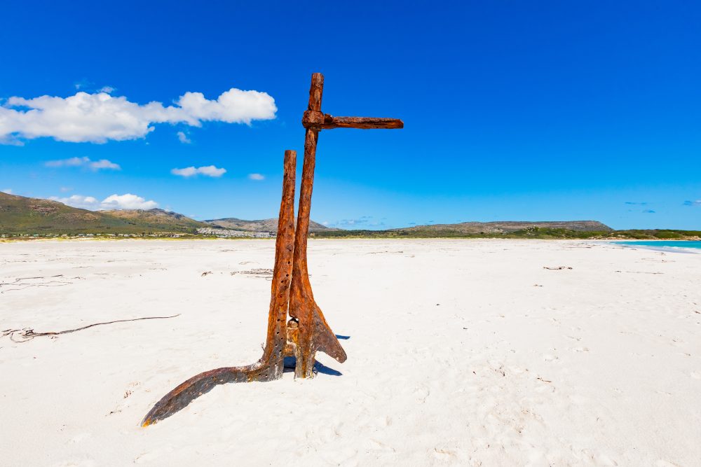
The SS Kakapo was on her maiden voyage from Swansea in the United Kingdom to Sydney with a crew of 20, carrying coal. There were no casualties from this incident, and all crew members safely reached the shoreline. The vessel was never refloated, and the remains of her still lie buried in the sand at the high tide mark. After World War I which ended in 1918, much of her hull plating was removed and used as a barricade on Fish Hoek beach to stop sand being blown onto the road and railway lines. Her remains lay high and dry above the tide line and her boilers have become somewhat of a tourist attraction. The site is easily accessible from the beach and has become a recognizable landmark for visitors exploring the Noordhoek coastline.
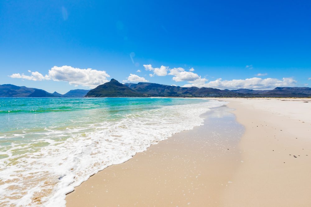
Furthermore, the wreck is located in a coastal dune and sandy beach environment, subject to strong Atlantic winds, tides, and seasonal storms. The north westerly gales that caused the shipwreck are characteristic of the area, and the high energy beach environment has helped preserve the remains in situ while also making them a visible part of the shoreline landscape. In addition, the SS Kakapo rests on sandy beach deposits at the high tide mark, with parts of the hull and boilers embedded in the sand. The surrounding geology includes coastal sandstone cliffs and dunes, which shape both the deposition of sand and the preservation of the wreck. Portions of the hull were later repurposed after World War I as barricades at Fish Hoek to prevent sand encroachment onto roads and railways, demonstrating interaction between human activity and the coastal geology.
GPS Waypoints: 34°07'25.09"S 18°20'56.06"E