Apostle Battery
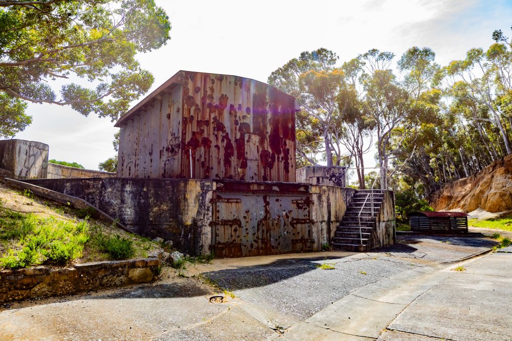

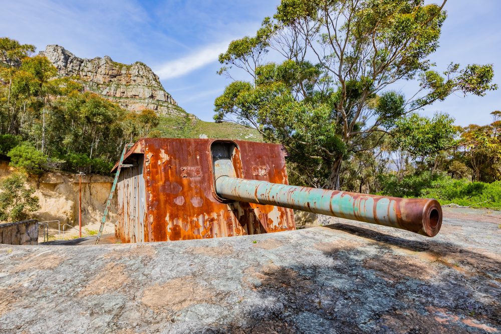
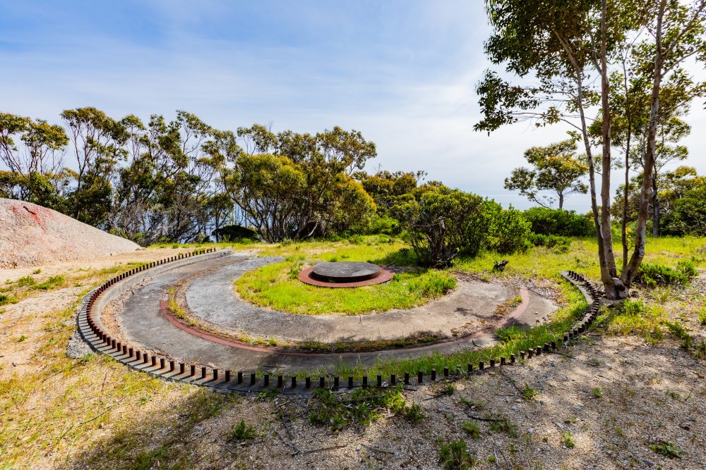
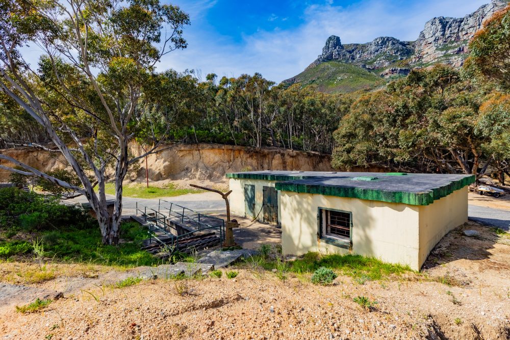
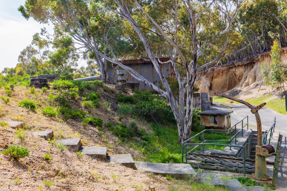
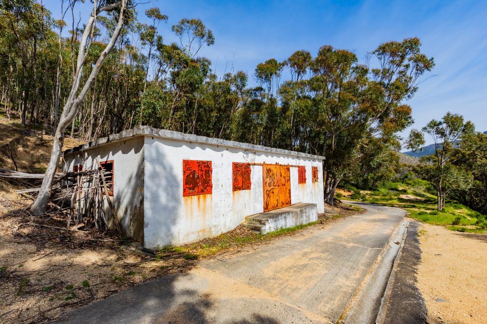
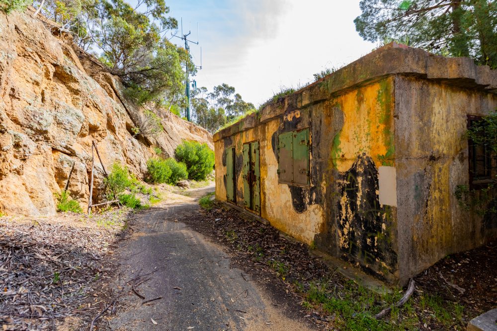
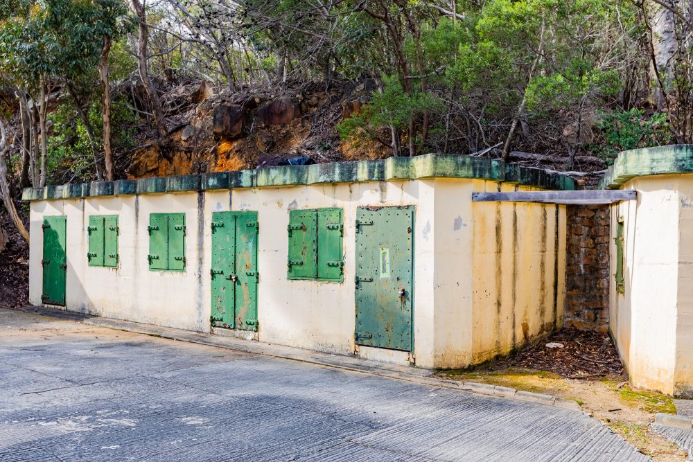
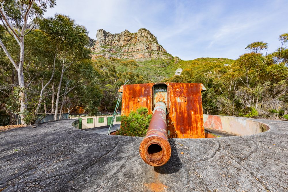
The Apostle Battery, initially called Duiker Point Battery, is a World War II structure that was designed by Col. Piet de Waal to act as a critical defence mechanism. It was called the Apostle Battery because of its location on the mountain range that is known as the 12 Apostles. Defined by the three original gun sites, it thus holds much historical value in the Cape Peninsula since its construction began in 1939. It was associated with gun batteries found at Robben Island and Simon’s Town to serve as a strategic naval defence site for Cape Town. Besides the three guns, the Apostle Battery is further characterised by tunnels, underground operation rooms, SSS radar stations, and ammunition magazines. This illustrated the technical and tactical sophistication of the installation. Additionally, the geology of Apostle Battery is built on Table Mountain Sandstone formations, which provided a strong and stable foundation for heavy gun emplacements and underground structures. The rocky ridges and steep slopes of the 12 Apostles facilitated the construction of tunnels, underground operation rooms, and ammunition magazines, while the natural topography allowed for strategic positioning of the gun batteries with clear lines of sight over the coast and ocean approaches.
Furthermore, the battery occupies a prominent mountainous ridge overlooking Hout Bay, with the surrounding landscape forming a major visual threshold into the valley, kloofs, and ravines of the area. Its elevated position provides sweeping views of the coastline, mountains, and settlements below, including Llandudno, offering both strategic military advantage and a striking aesthetic link between the mountain and the Atlantic Ocean. The site is surrounded by fynbos vegetation typical of the Cape Peninsula, integrating the military structures into the natural landscape. The natural landscape qualities of the Nek is a prominent visual feature, and major threshold into the Hout Bay Valley and of the Kloof and ravine as a form giving element, providing a green edge to the Llandudno settlement and a visual-spatial link between the mountain and coast.
Today, the site stands as a heritage landmark, offering insights into wartime military engineering and strategy while also contributing to the visual and cultural landscape of the Cape Peninsula, bridging the mountain and coastal environment.
GPS Waypoints: 34°0'12.53"S 18°20'54.74"E