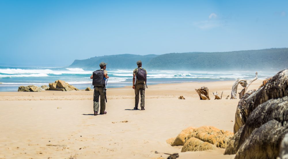
Otter Trail
The Otter Trail is a five (5) day hiking trail which starts at the Storms River Mouth Rest Camp and ends at the small resort village of Natures Valley in the de Vasselot section of the park.
The trail hugs the Tsitsikamma coast close to the pounding surf and zigzags where the coastal plateau rises to an elevation of 200 meters and cliffs drop steeply into the sea. The total distance for the trail is 42km and there are six (6) escape routes that have forest huts for resting.
Due to the physical demands of the Otter Trail, the following age restrictions are in place: Minimum age 12 years; maximum age 65 years.


Reservations and Tariffs
Booking and tariff enquiries should be directed to:
- Public Requests
- Email: [email protected]
- Telephone: +27 (0)12 428 9111
- Specialised Reservations
- Email: [email protected]
- Telephone: +27 (0)12 426 5111
- Travel Trade Requests
- Email: [email protected]
- Telephone: +27 (0)12 426 5025
Due to the physical demands of the Otter Trail and out of caution, it is compulsory for all Otter Trail participants/hikers to:
- Ensure that our custom Medical Questionnaire Examination Certificate is completed, signed and stamped by a registered medical doctor prior to arrival at Storms River Mouth Rest Camp.
- Hand in the completed, signed and stamped Medical Questionnaire Examination Certificate at Storms River Mouth Rest Camp Reception on arrival.
- Complete and sign the Disclaimer Notice and Indemnity Form
General Information
Check-in & Check-out
Check-in
Allow some time to weigh your bag and watch the 20 minute Otter Trail DVD at the Otter Room next to the Storms River Reception building. The Otter Trail DVD provides a brief outline of changes recently made to the trail.
Check-out
Compulsory check out at De Vasselot Rest Camp where Otter Trail certificates will be issued.
Distances & Durations
The trail is 5 days and 4 nights. The following distances and durations are as follows:
- Day 1 = 4.8km (± 2 hours)
- Day 2 = 7.9km (± 4 hours)
- Day 3 = 7.7km (± 4 hours)
- Day 4 = 13.8km (± 6 hours)
- Day 5 = 10.8km (± 5 hours)
- Total Distance = 45km
Map
Water
There are numerous streams and springs throughout the length of the Otter Trail that are suitable for drinking purposes. Please note though that water from the Kleinbos River is not suitable for drinking (2nd day of trail). However, it may be wise to use purification tablets especially if you are not used to this water and where streams/rivers pass through communities such as the Coldstream/Witels River (3.6km mark of the 4th day) and the Lottering River (7.5km mark of the 4th day). There are rainwater tanks at each overnight hut that may also be used. However, due to erratic rainfall patterns, the level of these tanks may be low from time to time. Water quality is monitored on a quarterly basis.
Firewood
Firewood is provided, however it is not covered from rain and therefore may be wet. Hikers are required to carry their share of wood from a woodpile, close by on the trail. However, it sometimes happens that there is a buildup of excess wood not used by previous hikers that is placed under the steps of the huts, which is usually dry.
Cooking Facilities
Each hut has a braai place with a sturdy steel grid. Within each hut there is a table on which food can be prepared. Hikers need to provide their own gas stoves and pots for cooking.
Other Facilities
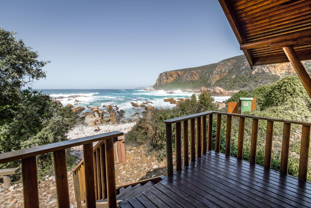
There are two huts and a single toilet at each overnight stop. Each of the two huts contains 6 beds with mattresses – hikers must provide their own blankets/pillows/sleeping bags etc. Rubbish bins are provided at each of the overnight stops. Field rangers remove the rubbish regularly. There are benches present. Please only use biodegradable soaps on the trail. Hikers are not permitted to remove mattresses from the huts.
Tides
It is important to be aware of the dates and the times of the high and low tides prior to hiking the Otter Trail. This is especially important when it comes to crossing the bigger rivers such as the Elandsbos and the Bloukrans Rivers. It is the hiker’s responsibility to obtain tide tables in order to prepare for their hike.
The Bloukrans River Crossing
The Bloukrans River crossing is on the 4th day of the Otter Trail. It is approximately 10km from Oakhurst Hut that takes about four and half hours (4.5) to reach. This river is best crossed during low tide. Once the river has been crossed it is approximately another 3.8km (two and a half hours) to the next overnight stop. It is wise to arrive well before low tide, so that enough time is available to plan your crossing.
If you are unable to cross the river, you can take the escape route labeled E6. This escape route branches to the right of the trail just before the Otter Trail descends to the Bloukrans River Mouth. The escape route climbs steeply to the top of the plateau. In the case of an emergency, hikers are advised to make their way to the top of the escape route and wait for collection by SANParks Rangers once contact has been made. Do not attempt to walk to the N2.
Safety Precautions
Safety items that can be included are the following:
- Small First Aid kit
- Survival Bag
- Thermal blanket
- Map of Trail
- Cellphone
- Rope
Cellphones and Reception
It is advisable that a cellphone is taken together with the following numbers:
- SANParks Rangers:
- Day 1 – 4: +27 (0)72 917 5079
- Day 5 – 6: +27 (0)72 917 4474
- Storms River Police – 10111
- Park Headquarters: +27 (0)42 281 1607
There is no cellphone reception along the Otter Trail. In the case of an emergency, hikers are advised to make their way to the top of the escape route where cell phone reception is available.
Emergency Procedures
Escape routes are only to be taken in the case of an emergency. The escape routes are indicated as E 1 – 6 on the map. Cell phone reception may be reached at the top of the escape route. Hikers are to contact SANParks Rangers immediately upon reaching the top of the escape route and should then wait at the entrance to the escape route for collection.
- Escape route 1 – is 2.8km from the rest camp into the natural forest leading to the Ngubu huts inside the natural forest.
- Escape route 2 – the Kleinbos River escape route is 4.8km from the Ngubu huts to the river.
- Escape route 3 – Bloubaai escape route is 4.6km and has overnight stops which are the forest huts.
- Escape route 4 – Scotts hut/ Geelhoutbos Rivers is 3.6km and has overnight stops which are the forest huts.
- Escape route 5 – Jan Swart escape route is 3km and has overnight stops which are the forest huts.
- Escape route 6 – Bloukrans River towards the end of the trail and has overnight stops which are the forest huts.