Southernmost Tip of Africa
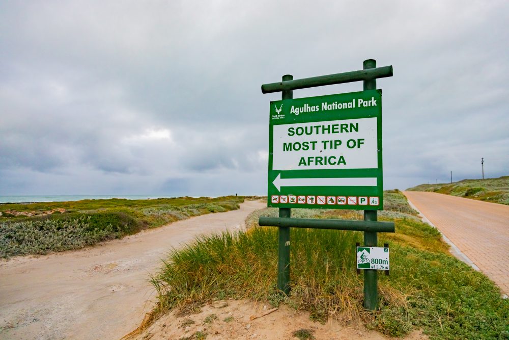
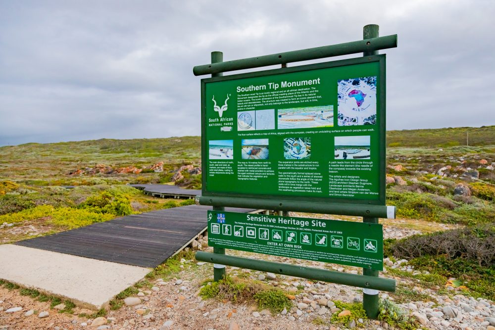
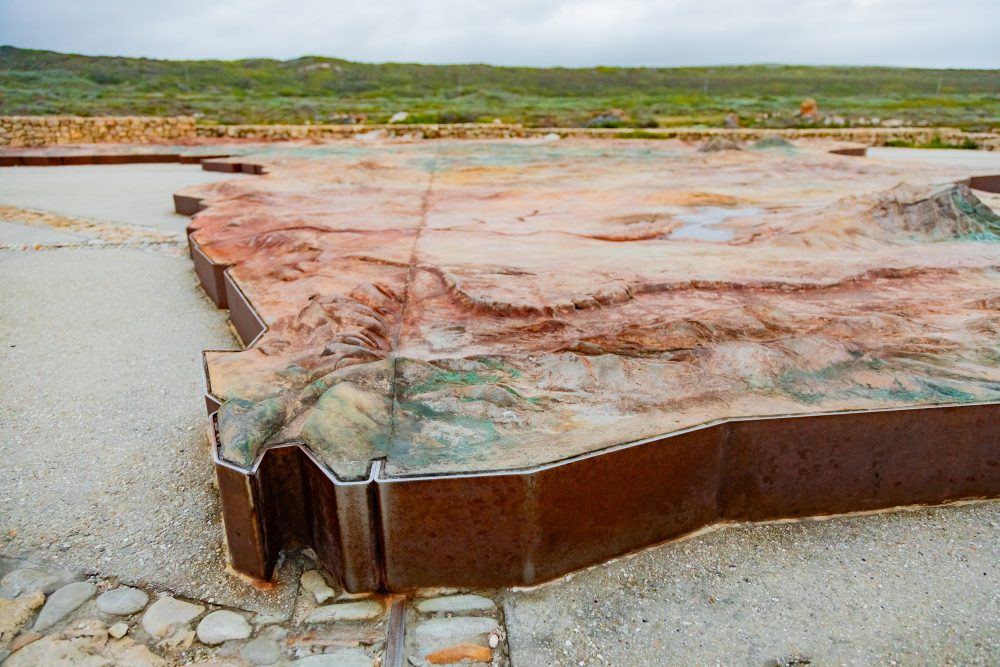
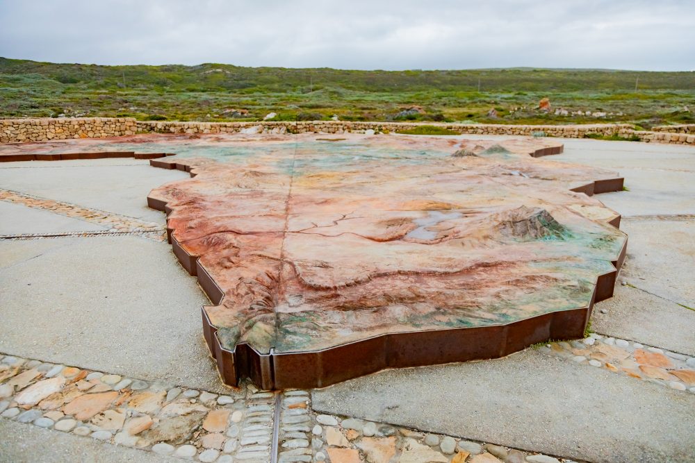
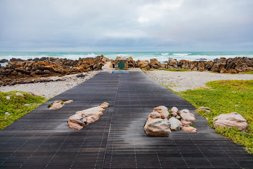
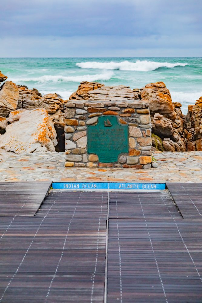
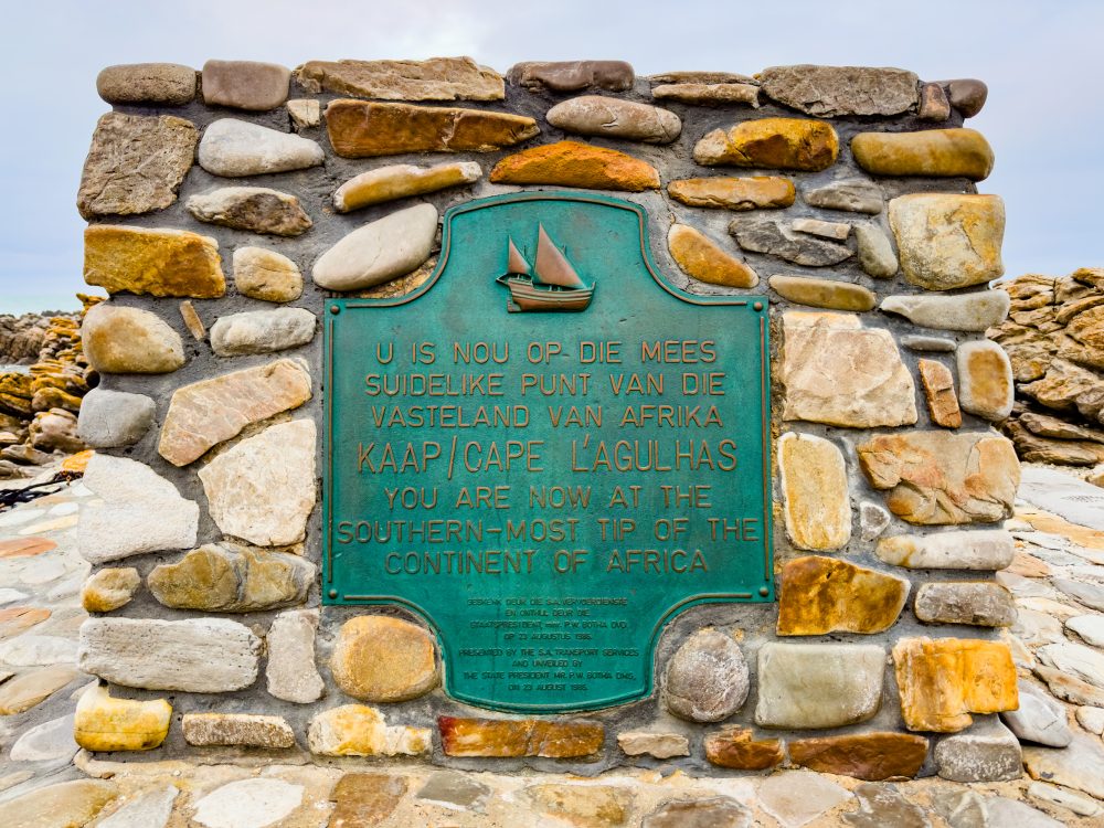
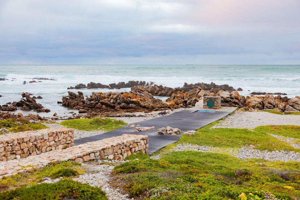
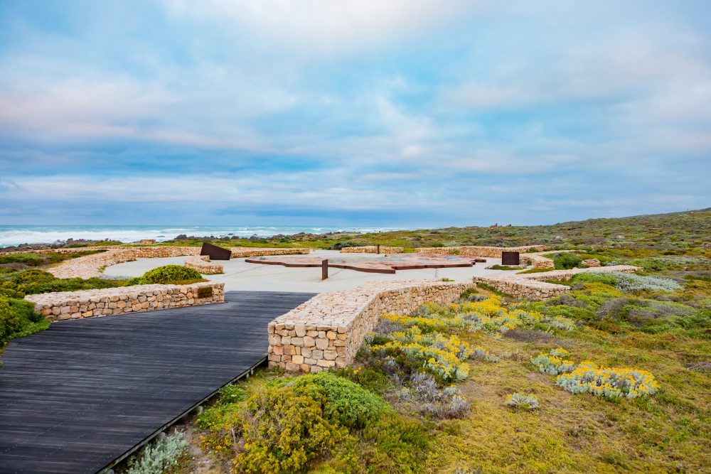
The Southernmost Tip of Africa is located only a short distance from the Cape Agulhas Lighthouse. It marks the precise geographic point where the African continent reaches its furthest extent southward. A stone cairn and interpretive signage commemorate the location, allowing visitors to stand at the literal end of the continent while overlooking the vast expanse of ocean stretching toward Antarctica.
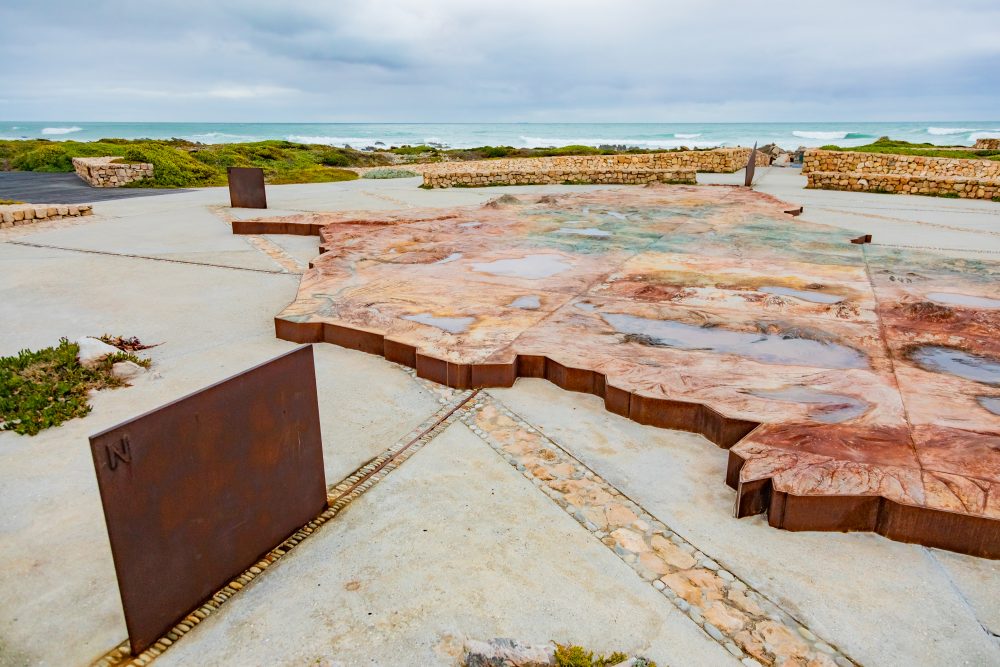
The point is positioned along a rugged, windswept coastline characterised by low, salt-tolerant fynbos vegetation and dramatic rock formations shaped by persistent marine forces. Additionally, the geological character of the Southernmost Tip is defined by exposed coastal limestone and ancient sedimentary formations that form part of the broader Agulhas plain. These strata include calcareous sandstones and compacted marine deposits that have been sculpted by erosion into flat, wave-cut platforms and fractured rock ledges. The durability of these formations has allowed the coastline to retain its distinctive appearance, with sharp, angular outcrops and tide pools that support a variety of marine organisms.
The Southernmost Tip of Africa holds profound maritime, navigational, and symbolic meaning. For centuries, it has represented both a milestone for global explorers and a psychological threshold between different worlds – transitioning from one great ocean system to another. Long before modern cartography confirmed its coordinates, the region was recognised by seafarers as a critical turning point on the trade routes between Europe and the East. Today, the stone cairn marking the tip has become an iconic landmark, offering visitors a tangible connection to the geographic identity of the continent.
The site forms part of the broader heritage landscape of Cape Agulhas, complementing the historical significance of the nearby lighthouse and the long maritime history of the surrounding coast. It remains a compelling destination for travellers who seek to experience a sense of continental scale, geographical extremity, and the raw beauty of the southern ocean environment.
GPS Waypoints: 34°49'59.1"S 19°59'59.9"E