Shipwrecks and Maritime Heritage


Cape Agulhas is located along one of the world’s most significant global trade routes, which was historically used extensively by Dutch, British, Portuguese, and French vessels navigating between Europe and the East. The coastline bears testimony to this history through the remains of numerous shipwrecks, some of which are among the earliest recorded maritime disasters off the South African coast.
The high incidence of shipwrecks along the Agulhas coastline coast is directly related to the challenging maritime environment at the southern tip of Africa. The region is marked by strong winds, unpredictable weather systems, powerful swells, and the meeting of cold and warm ocean currents. Before the advent of modern navigation and the construction of the Lighthouses at Cape Agulhas (first built in 1849), vessels were especially vulnerable to these conditions, leading to centuries of maritime tragedy along the Agulhas coast.
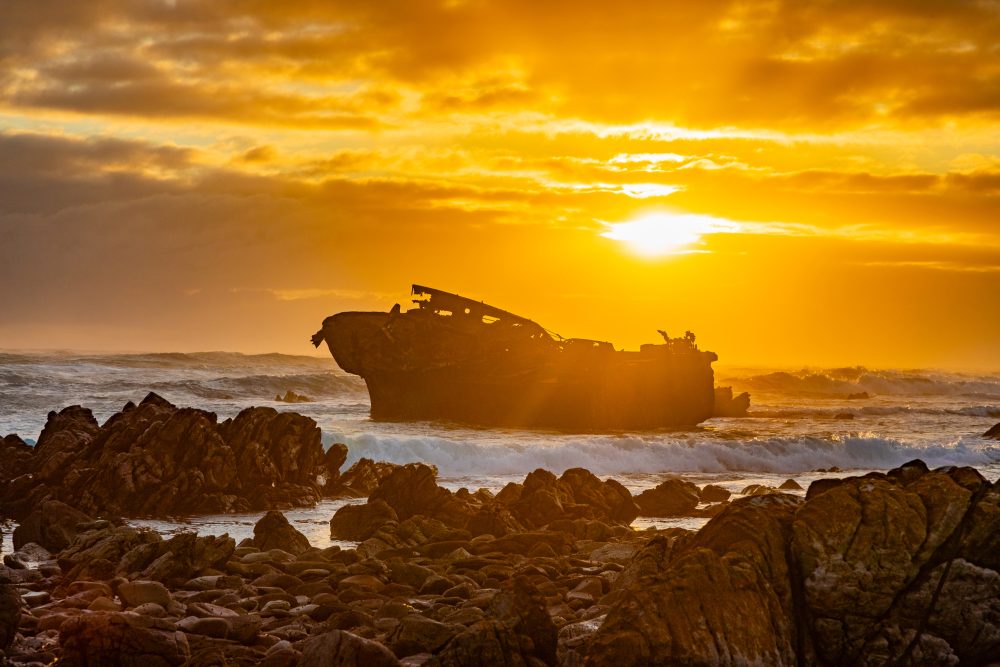
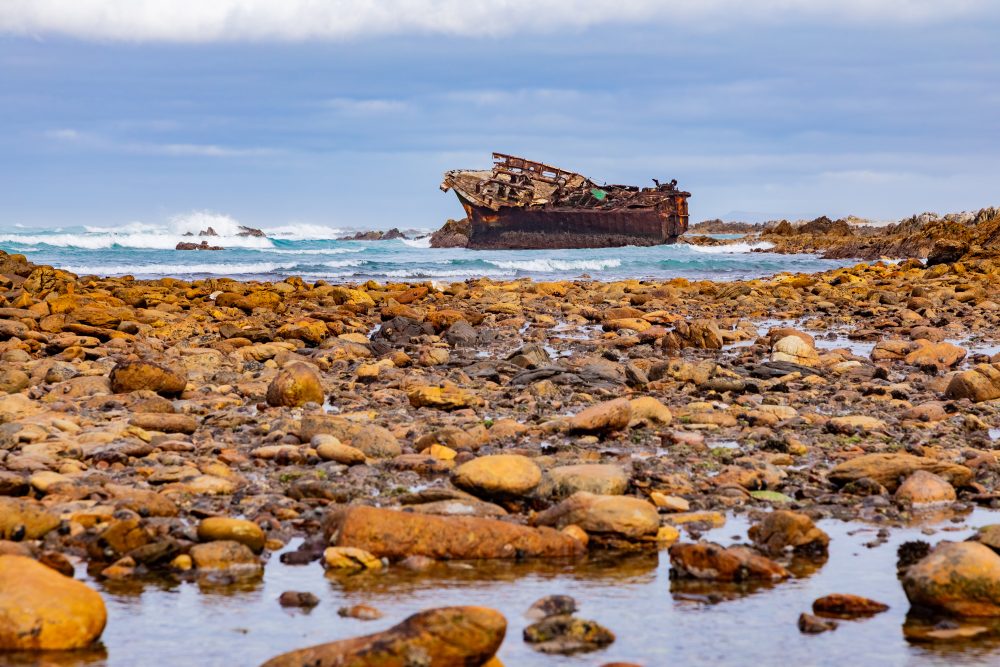
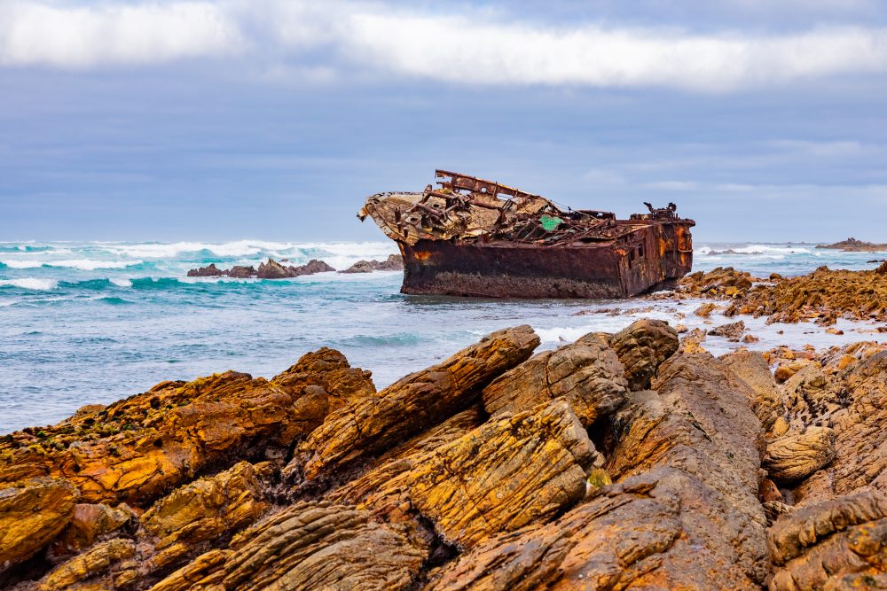
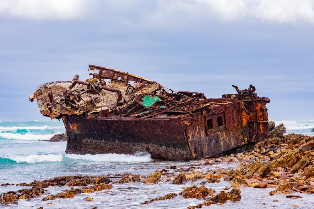
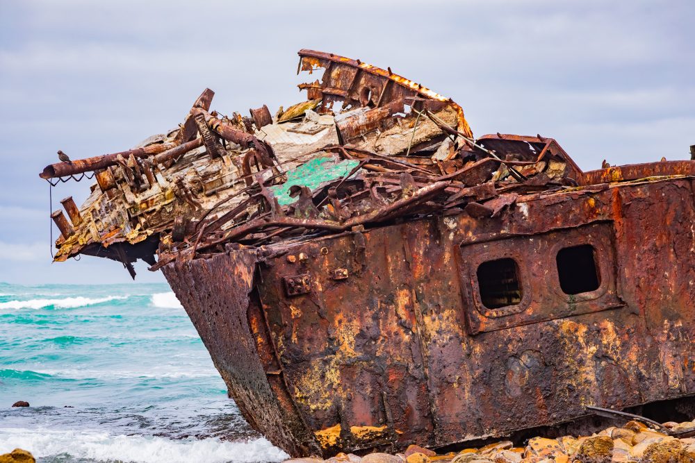
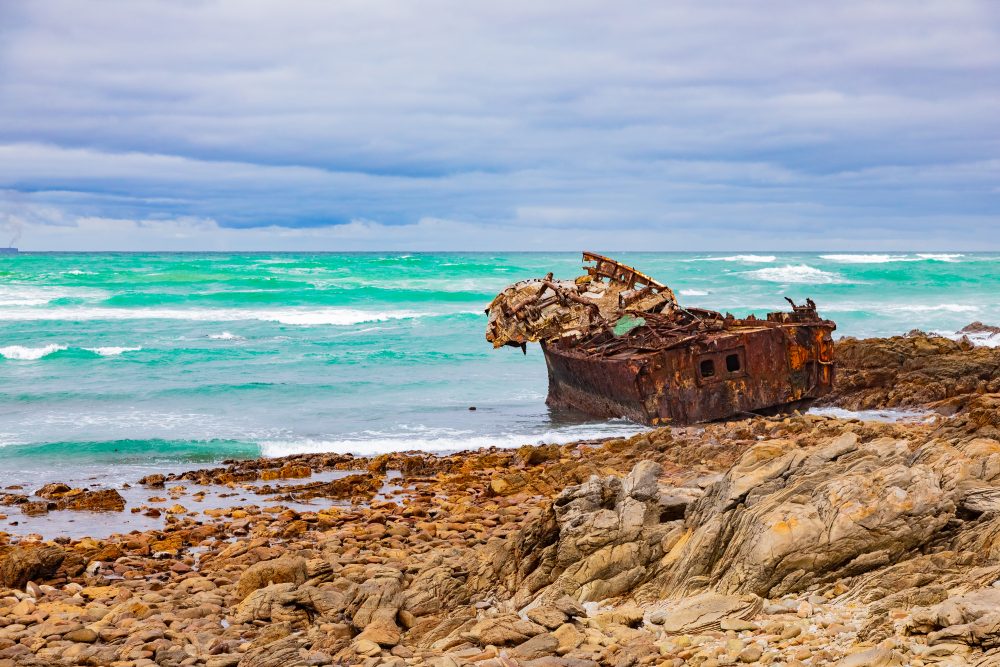
Some notable shipwrecks along the Agulhas coastline include (i) Zoetendal (1673) – one of the earliest recorded wrecks in the region, belonging to the Dutch East India Company, (ii) Arniston (1815) – a British transport ship that wrecked near Waenhuiskrans (Arniston), resulting in heavy loss of life and the naming of the nearby village, (iii) , Birkenhead (1852) – famous for the ‘Birkenhead Drill’, one of the earliest recorded instances of ‘women and children first’ during a maritime evacuation, and (iv) Meisho Maru 38 that wrecked on the 16th of November 1982. It is only the Meisho Maru 38 that is still visible along the shores of Cape Agulhas. Collectively, these wrecks provide a chronological cross-section of maritime technology, trade, and naval history, reflecting evolving shipbuilding practices and the increasing complexity of global seafaring from the 17th to 19th centuries.
The historical incidences that led to the wreckage of ships along Agulhas coastline has greatly influenced the region’s cultural narrative, reinforcing its identity as a perilous but vital maritime corridor. These incidences serve as a poignant reminder of the dangers faced by early seafarers and the global significance of the Cape as a crossroads of oceanic travel.
The Bredasdorp Shipwreck Museum plays a central role in preserving this heritage, housing artifacts and interpretive displays that contextualize the events and human stories connected to the wrecks. Together with the Cape Agulhas Lighthouse, these maritime sites form a cohesive heritage landscape that highlights both human resilience and the formidable power of the sea. Lastly their enduring presence along the coastline serves as a poignant reminder of the dangers faced by early seafarers and the global significance of the Cape as a crossroads of oceanic travel.
GPS Waypoints: 34°49'46.9"S 19°59'02.4"E