Map of Africa Monument
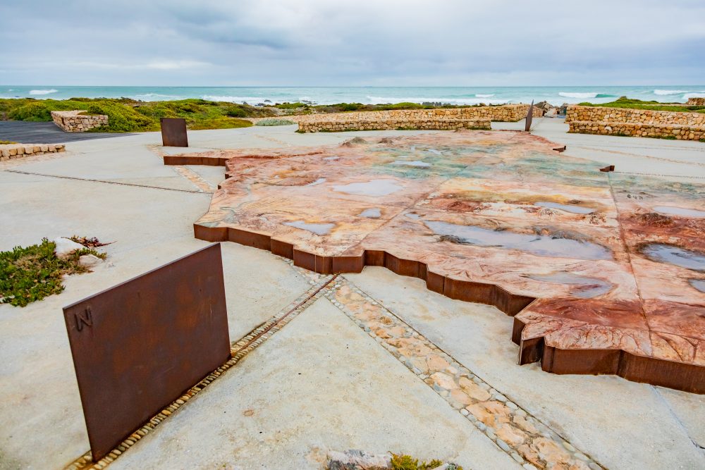
This monument is positioned along the coastal boardwalk that links key visitor attractions, occupying a prominent vantage point overlooking the shoreline. Its design and location allow visitors to engage simultaneously with the cultural symbolism of the monument and the dramatic natural surroundings that define the southern edge of the African continent.
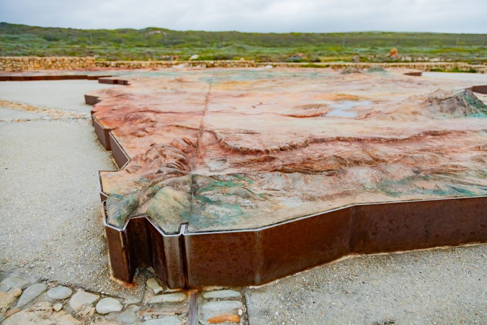
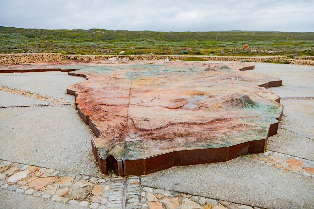
The monument is an artistic, stylised stone representation of the African continent, laid out horizontally within the Agulhas landscape. Constructed from locally sourced stone and set against the backdrop of fynbos vegetation and expansive ocean views, the feature blends seamlessly with its environment while maintaining high visual impact. Visitors can walk around the installation, gaining an elevated appreciation of Africa’s geographic form while standing at its symbolic ‘southernmost point’.
The setting reflects the park’s characteristic natural features of wind-sculpted coastal vegetation, exposed limestone outcrops, and panoramic views of the meeting oceans. The monument’s placement encourages contemplation of both the continent’s physical geography and the ecological richness protected within Agulhas National Park. Its creation reflects the park’s broader mandate to preserve not only the natural environment but also the historical and cultural narratives associated with the region.
For many visitors, the monument enhances the emotional and symbolic significance of reaching the southern end of the African continent, an experience reinforced by the nearby cairn marking the southernmost tip of the continent. The Map of Africa Monument thus bridges geography and heritage, inviting reflection on Africa’s history, ecology, and diverse cultures. The monument enriches the visitor journey by offering a visually engaging, educational, and reflective landmark that complements the many historical and natural features of Cape Agulhas.
GPS Waypoints: 34°49'57.1"S 19°59'59.8"E