Where did the tags pop off? Early results from the April 2025 white shark tagging expedition, Mossel Bay
On 10–11 April 2025, Dr Alison Towner (South African International Maritime Institute) and Dr Alison Kock (South African National Parks) led a collaborative expedition with marine biologist Don Marx (Southernmost Apnea) aboard White Shark Africa’s research vessel to deploy Mini-PAT (pop-up archival) satellite tags from Wildlife Computers on white sharks in Kleinbrak, Mossel Bay.
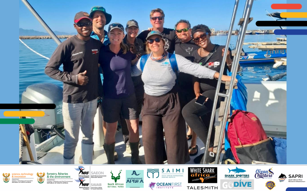
This research was made possible through the collaborative efforts of our field partners and supporting institutions, including NRF-SAEON, SAPRI, DSTI, NRF-SAIAB, SANParks, SAIMI, Shark Spotters, DFFE, White Shark Africa, Go Dive, Ocean Charters, Oceans First Institute, and Warner Brothers Discovery.
Over just two days, the team encountered 11 individual sharks and successfully tagged 8 using a bait lure and a specialised tagging pole, an entirely non-invasive technique that avoids capturing or restraining the animals. This low-impact approach minimises stress while providing high-quality data on the sharks’ three-dimensional movements and habitat use.
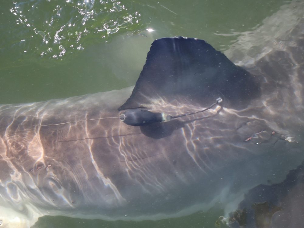
Mini-PAT satellite tag attached to a white shark, captured shortly after deployment (Photo: Melissa Nel, Shark Spotters)
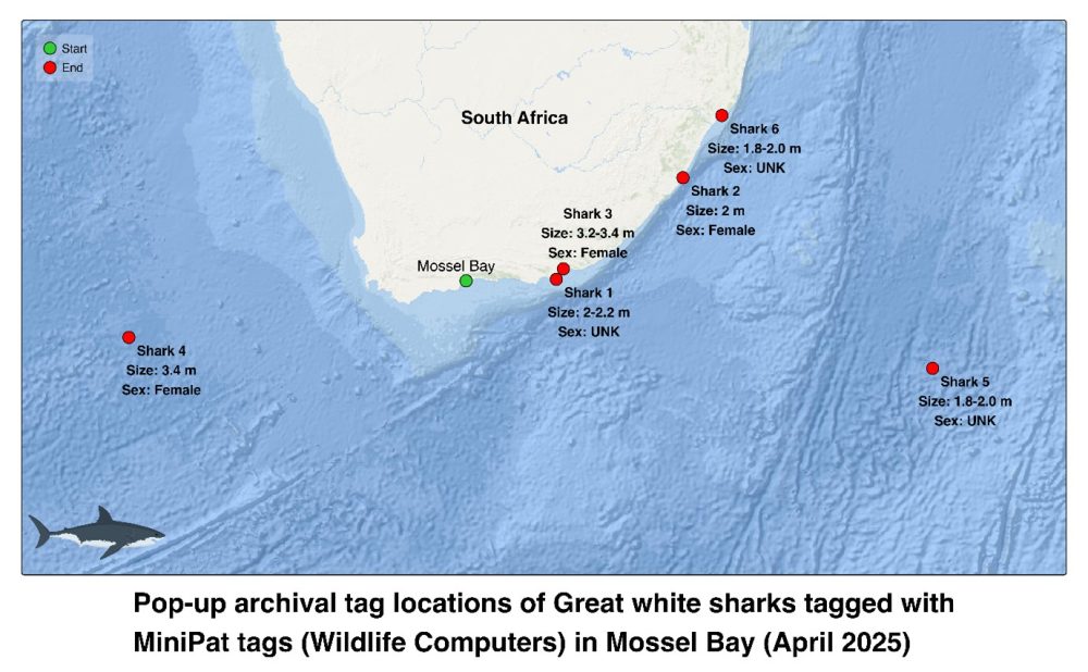
Six months later, the tags have begun to detach and transmit their data as programmed, offering exciting new insights into how South Africa’s white sharks are moving through and beyond local waters as they adapt to a changing ocean. Shortly after tagging, one of the tagged sharks was caught on a drumline near Margate, KwaZulu-Natal, underscoring the ongoing pressures and complex human–wildlife interactions along South Africa’s coast. Three tags have surfaced close to the South African coastline, near Schoenmakerskop in the Eastern Cape, along the Sundays River in Addo Elephant National Park MPA and near Richards Bay in KZN. In contrast, two others have popped up far offshore, one in the middle of the Indian Ocean and another deep into the Atlantic. We are still waiting for two more tags to detach and transmit their data.
When tags are successfully retrieved, the full high-resolution dataset can be downloaded directly from the tag, providing detailed information on depth, temperature, and movement over time. If the tags cannot be recovered, a summarised version of the data is transmitted via the Argos satellite system once the tag detaches and reaches the surface. While this remote transmission offers valuable insights, retrieving the physical tag allows for a much finer level of analysis and the opportunity to refurbish and reuse the device for future studies.
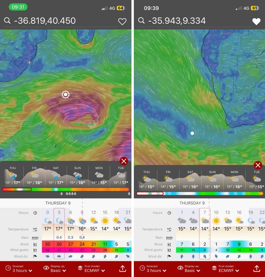
Two of the satellite tags popped off far offshore and could not be recovered. When overlaid with the prevailing weather conditions at the time, two very different scenarios emerged, one during extreme winds and rough seas, and the other in calm, flat conditions, highlighting the wide range of environments these tags endure.
Therefore, when a tag detaches nearshore, it triggers a race against time to recover it before it’s lost to currents, waves, or battery depletion. These recoveries often become high-stakes “Easter egg hunts,” with calls to friends, family and co-workers to coordinate and assist in searches by land and sea. Sincere thanks go to everyone who has assisted, especially Dr Toby Rogers (Shark Spotters) and Don Marx, who have travelled long distances, often overnight, equipped with an ICOM radio receiver to locate tags that couldn’t be found visually. A big thank-you to Toby for also managing all the satellite tag data, from downloading and safely storing it to applying models that help us reconstruct the sharks’ movements. These models use information such as light levels, depth, and temperature recorded by the tags to estimate where each shark has travelled, helping us build a clearer picture of their ocean journeys.
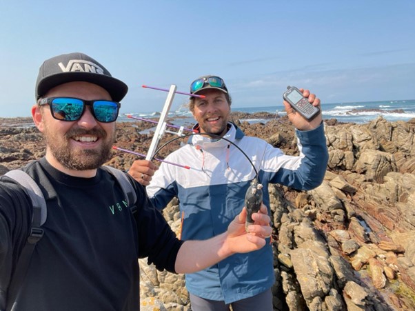
Dr Toby Rogers and Don Marx successfully located one of the satellite tags hidden beneath a rock ledge near Schoenmakerskop in the Eastern Cape using the ICOM antennae after it couldn’t be found by eye.
In the months ahead, the team will analyse data from both recovered and satellite-transmitted tags to map shark movements and gain new insights into how these iconic predators use South Africa’s coastline and offshore waters, as well as the factors that drive their movements. Substantial changes in previously known patterns have been documented over the last few years, underscoring the need to continue investigating what is happening and why. The work is ongoing, with plans to tag additional white sharks and deepen our understanding of how they respond to environmental change, ecological shifts, predator-prey interactions and human pressures along and beyond South Africa’s coast.
