Groundwater Hydrocensus in Agulhas National Park
What is a Groundwater Hydrocensus?
A groundwater hydrocensus is a process of documenting all the groundwater sites within a particular area. Groundwater sites refer to boreholes, natural springs where groundwater daylight and well points.
Why do we need to do this?
As national parks we need to manage all our natural ecosystems conserved in our parks. In order to manage it we need to understand their functioning. The recent drought experienced in South Africa also added pressure on our groundwater resources when dams and rivers dried up. National parks, especially those in the Central Karoo region, received applications to develop well fields, a series of boreholes, within or close to their borders. Thus, understanding the current groundwater ecosystem functioning and resources within the national parks will allow SANParks to better manage and monitor the resource, conserve groundwater dependant ecosystems, and mitigate against potential negative impacts of future regional aquifer developments (Petersen 2019).
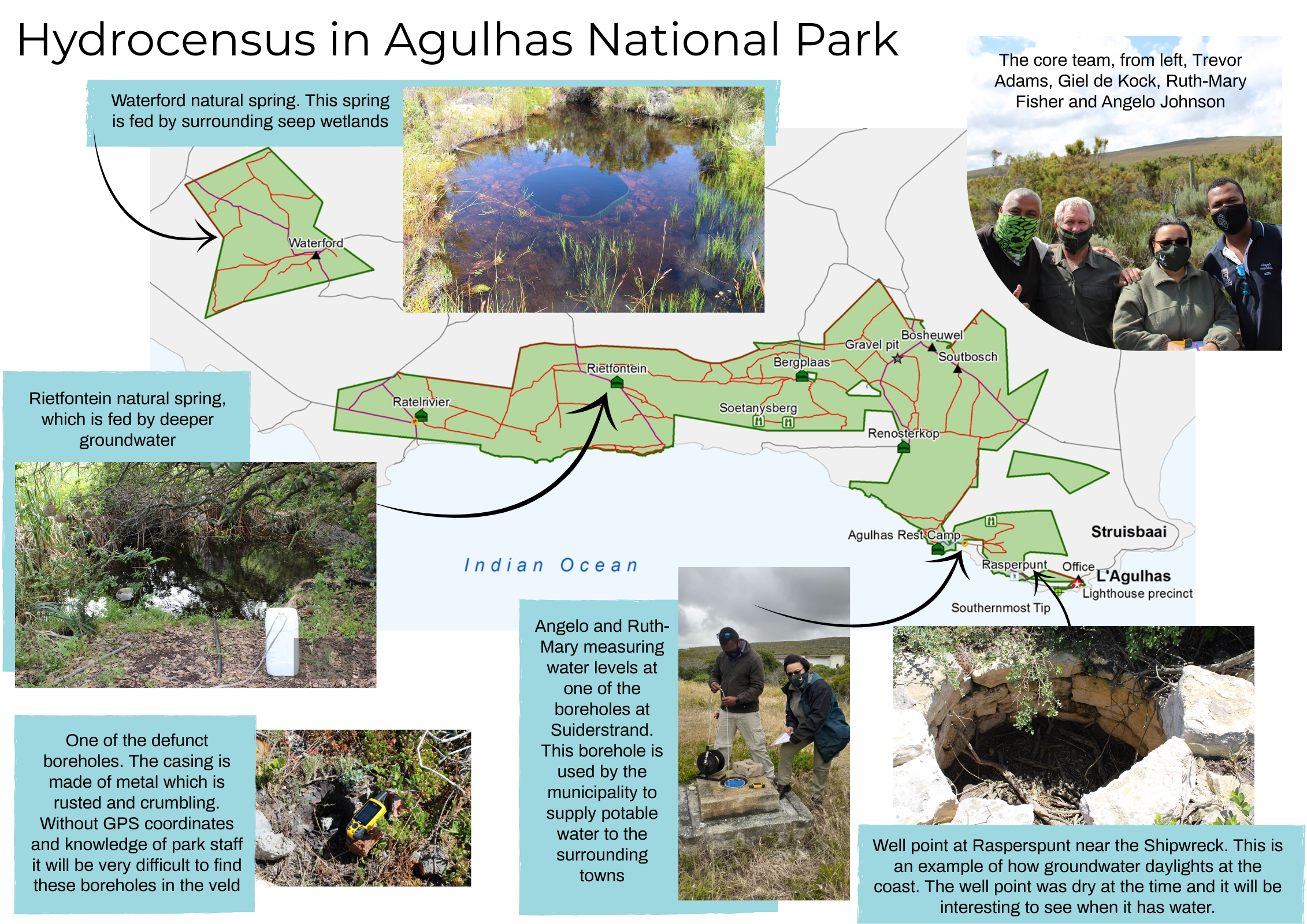
A groundwater census was conducted within Agulhas National Parks between 17-19 November 2020 by scientists from the Cape Research Centre (CRC), Park Planning Department and Agulhas park management. A total of 33 groundwater sites were documented, with 31 sites visited. These included natural springs at Waterford and Rietfontein, boreholes providing water to internal SANParks accommodation and offices and to the nearby towns. The hydrocensus documented the state of the groundwater sites (defunct or still in use), the depth and water levels at each borehole. The hydrocensus forms the foundation for the groundwater monitoring programme to be implemented for the park.