Chasing the tide of the rocky shores in the newly gazetted Namaqua National Park Marine Protected Areas
On the rocky shore,
seagulls play in the bright blue sky,
the salty sea spray splashes the bright shiny rocks,
the sand squishes between the toes.
The rocky shore is peaceful, and quiet.
On the rocky shore,
the seaweed crawls up the sand
like green fingers trying to escape the frothy sea.
The sun dries the salt on the rocks,
creating a white chalky powder
on the rocky shore.
I came across this poem written by a 10-year-old Nathan entitled “On the Rocky Shore” on social media. This poem ignites the passion of working on rocky shores, especially when the author mentions the splashes of the waves, seabirds and the white chalky powder making the scene of rocky shores come to life. Namaqua National Park (NNP) is regarded as a tranquil place, famous for the magnificent and colourful wildflowers that blossom in spring. The coastline of Namaqua National Park (NNP) is a designated Marine Protected Area (MPA), which supports incredible marine life, such as kelp forests, west coast rock lobster, limpets that come in different shapes and sizes, and mussel beds. The MPA also conserves cultural heritage sites, such as archaeological sites and shipwreck, and promotes environmental education, research and monitoring.
Little is known about the ecological impact of harvesting limpets from rocky shores, including the impacts of harvesting alien invasive species, such as Mediterranean mussels, which are known to displace and outcompete native mussels and other rocky shore species. There is also a significant gap in our understanding of the impact of inland diamond mining near the coast. Since 2015, SANParks and marine scientists from the Department of Nature Conservation and Department of Forestry, Fisheries and the Environment (DFFE): Ocean and Coast have been conducting annual rocky shore monitoring in NNP MPA and adjacent areas. The objective of the monitoring program is to gather baseline data that will provide an indication of long term changes in the rocky shore community structure and demographics of key populations that can be attributed to current growing pressures they face, which include harvesting, mining and alien invasion. Therefore, this kind of monitoring program is essential for developing conservation and management strategies.
A week-long field trip was conducted in Namaqua MPA between the 8th and 16th of August 2022. Most of the sampling days were warm and had calm sea conditions. Three shore-perpendicular transects were set up by installing fixed permanent markers (bolts at 5-m intervals). Along the permanent transects, the densities of limpets were sampled visually using 50×50-cm quadrats that were placed a meter apart across the different zones of the rocky shores during spring low tide. We randomly sampled ten quadrats for densities and measured 30 limpets in each quadrat per zone using callipers. Photo quadrats were taken using a 30×30-cm frame along the transect at 1-m intervals. Safety was always a priority and being out on the rocky shores with the team brought the excitement of being a team player when you shouted out to your colleague to “look out for the wave” during counts and measurements of limpets. We were consumed by an incredibly diverse array of the true limpet family (Patellidae), which is endemic to the south and west coasts of South Africa and Namibia. These limpets include granular, granite, argenville and pear limpets. Alien Mediterranean mussel beds were encountered in the mid-zone of the rocky shores. Variegated topshell was found in the high-shore crevices. It was interesting to watch a limpet lifting its shell from the rock in one of our sites at Sammy se baai. We were also excited to spot two seals in the rocks as well as superklipfish and a crab in the rock pool.
It was shocking to find one of our permanent monitoring sites in Michelle’s Bay, which was established in 2019, covered by sand spill-over as a result of mining activities close to the coast. This monitoring site is located between the boundary of Namaqua National Park and the north of Spoeg river mouth. Half of the rocky shore and its marine biodiversity was all gone along with one of our permanent transects in Michelle’s Bay. We also observed that the beautiful dunes that we used to walk in to get to our monitoring are gone due to mining activities. The sand is continuing to spilling over the remaining rocky shore, and some of the orange tag markers were covered by sand. However, we successfully completed monitoring all the sites and captured and compiled all the data and quadrat photographs. I deeply appreciate every team player for showing relentless effort from 2015 until now and extend my utmost gratitude for the collaboration and team work that we have maintained all these years.
Photos by Zoleka Filander and Louise Geldenhuys.
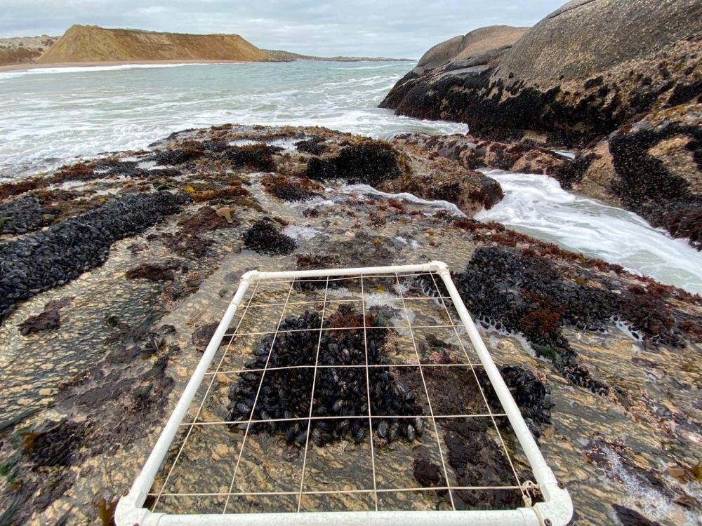
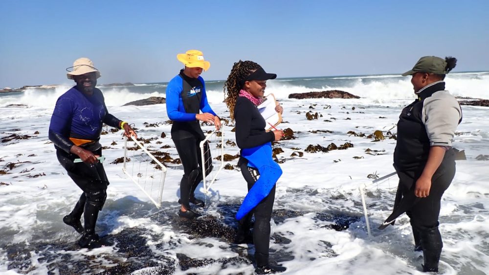
The 50×50-cm quadrats for densities of key limpets per zone
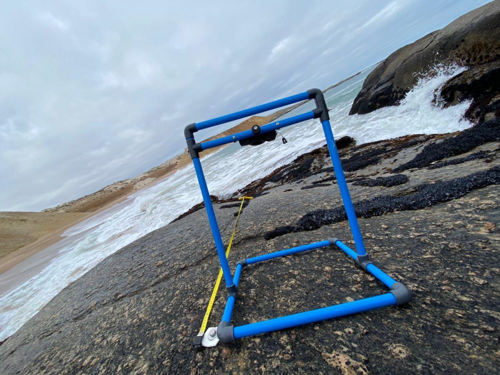
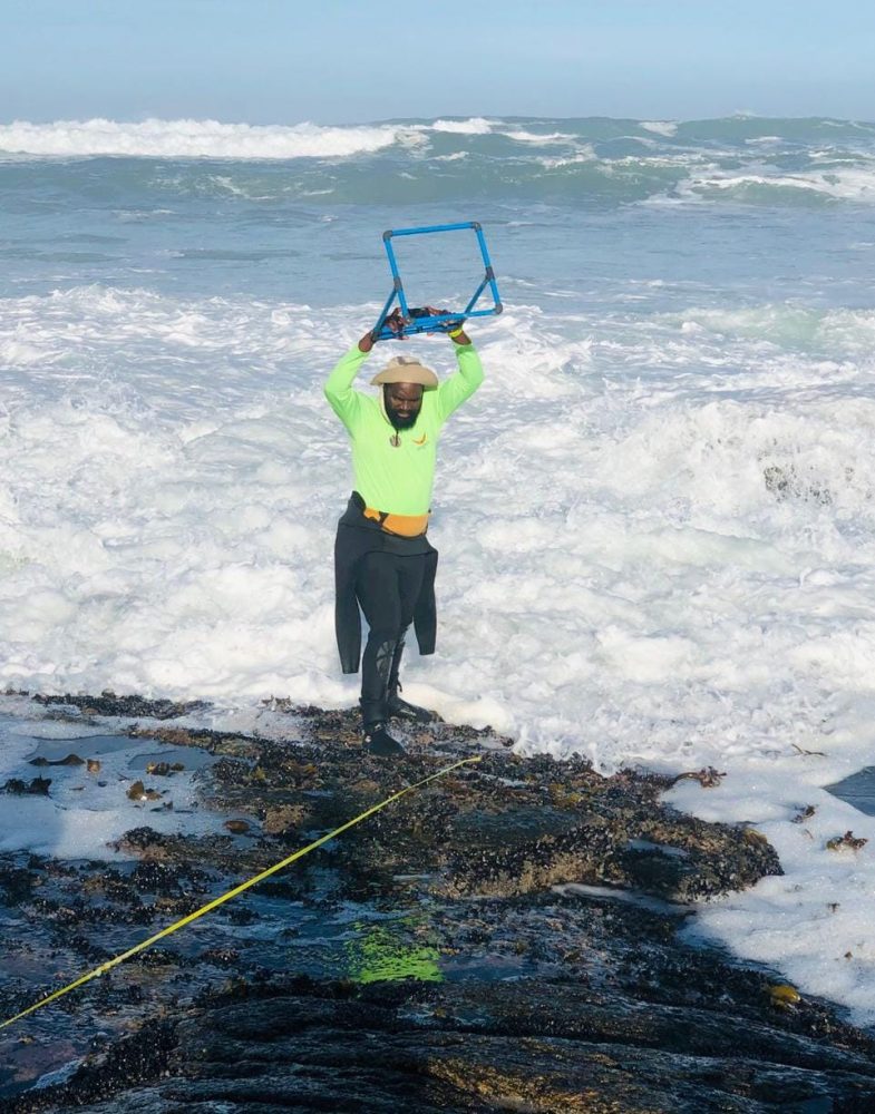
Quadrat photographs taken every meter apart using 30×30-cm frame at the beginning of the high-shore to the low-show towards the sea
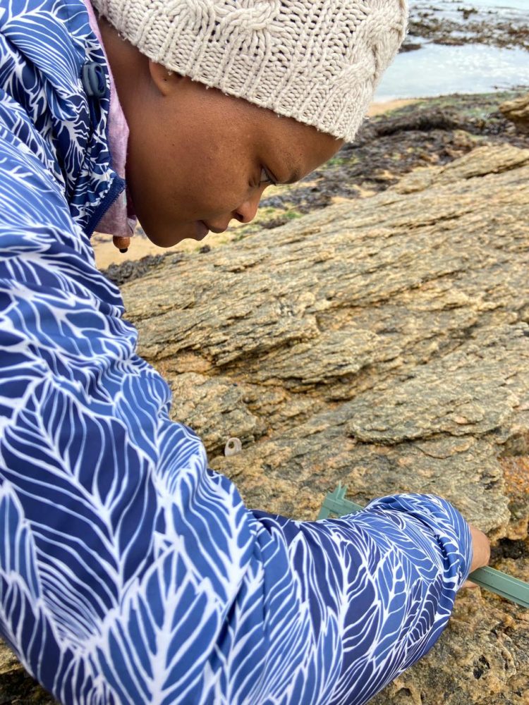
Measuring the sizes of limpets
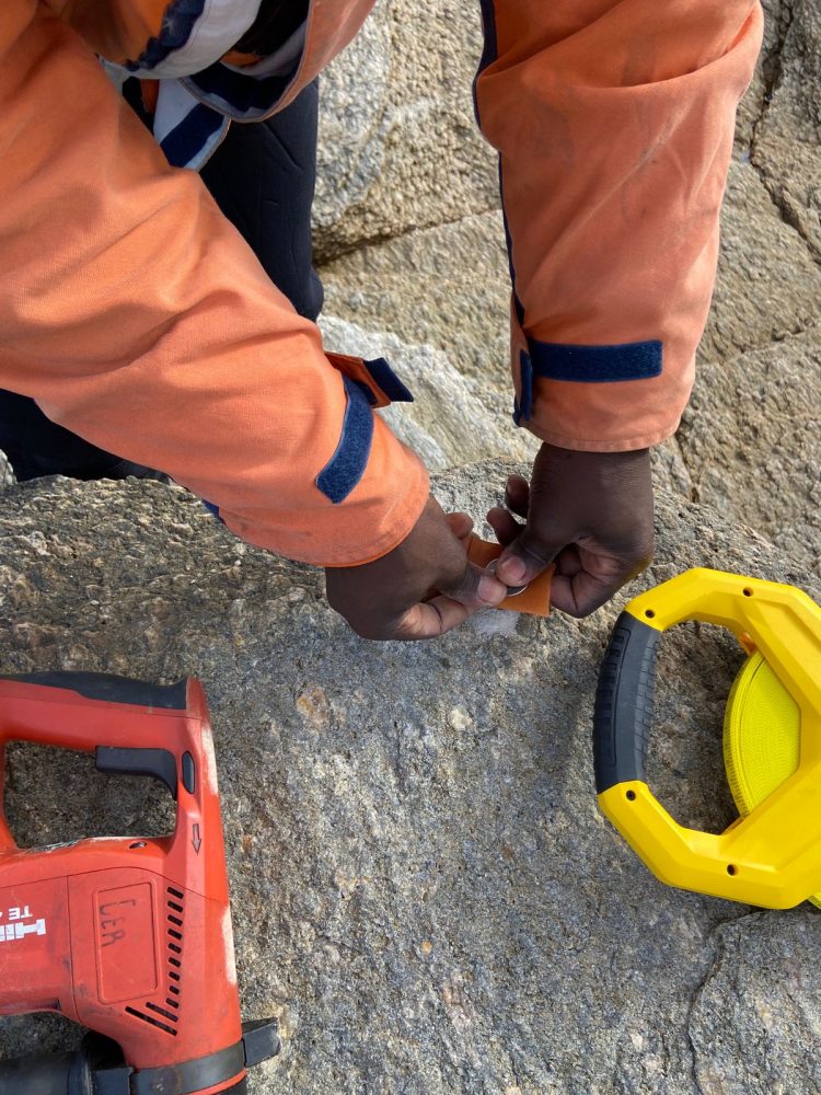
Installing the missing orange tag markers using bolts
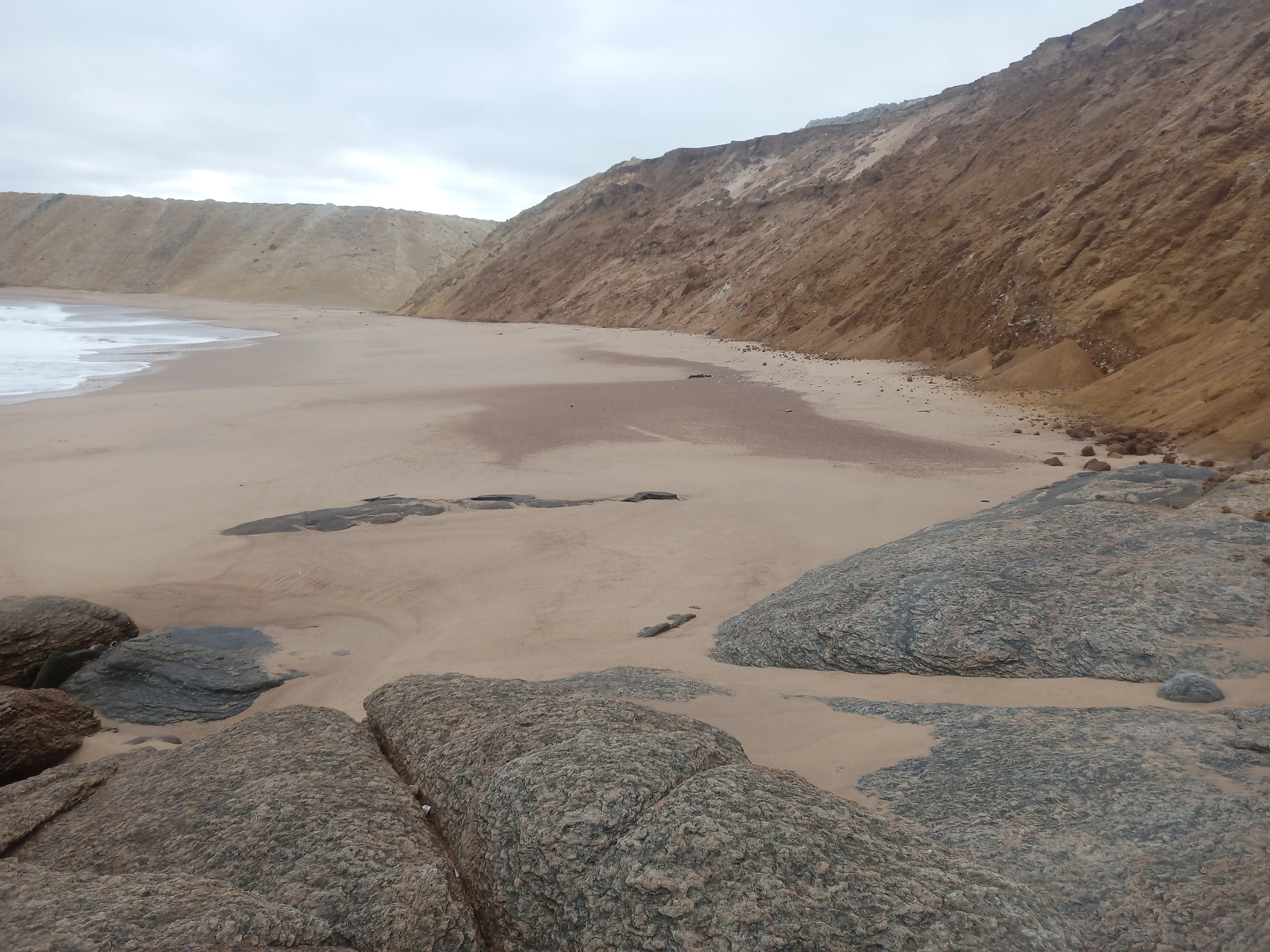
Sand spill over from the mining activities covering the rocky shores and their marine life at Michelle’s Bay. ©Sisanda Mayekiso
The team enjoying working in the low shore of rocky shores
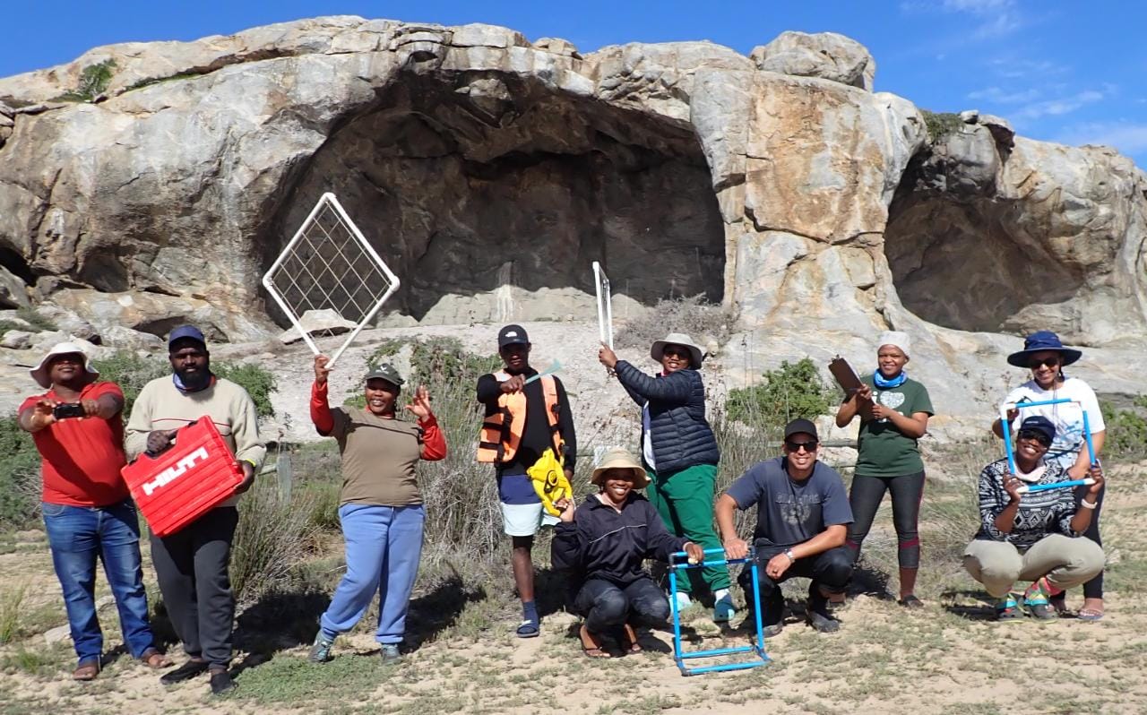
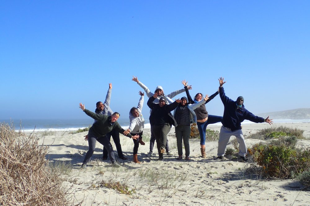
SANParks and marine scientists from the Department of Forestry, Fisheries and the Environment (DFFE: Ocean and Coast) after completing monitoring of intertidal rocky shores during calm sea condition in Namaqua National Park MPA. ©DFFE
