
Agulhas National Park Vegetation
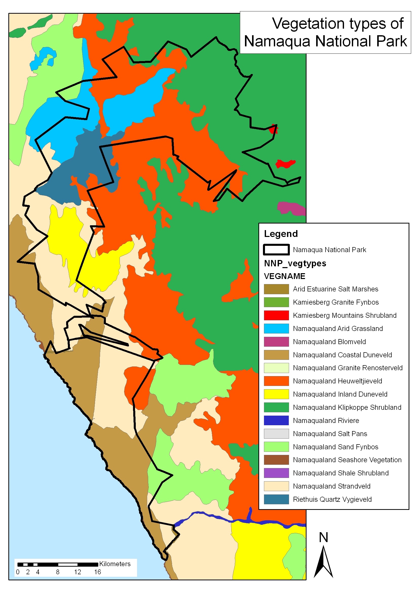
The map show the vegetation classification of Mucina and Rutherford (2006). This type of map is used as a reference when monitoring vegetation and when searching for Species of Special Concern.
The map show the vegetation classification of Mucina and Rutherford (2006). This type of map is used as a reference when monitoring vegetation and when searching for Species of Special Concern.

The fire of 26 December 2009 burnt over 60% of the park (at the time: 12688 ha of 20932 ha). The park expanded to 21235 ha in 2014.
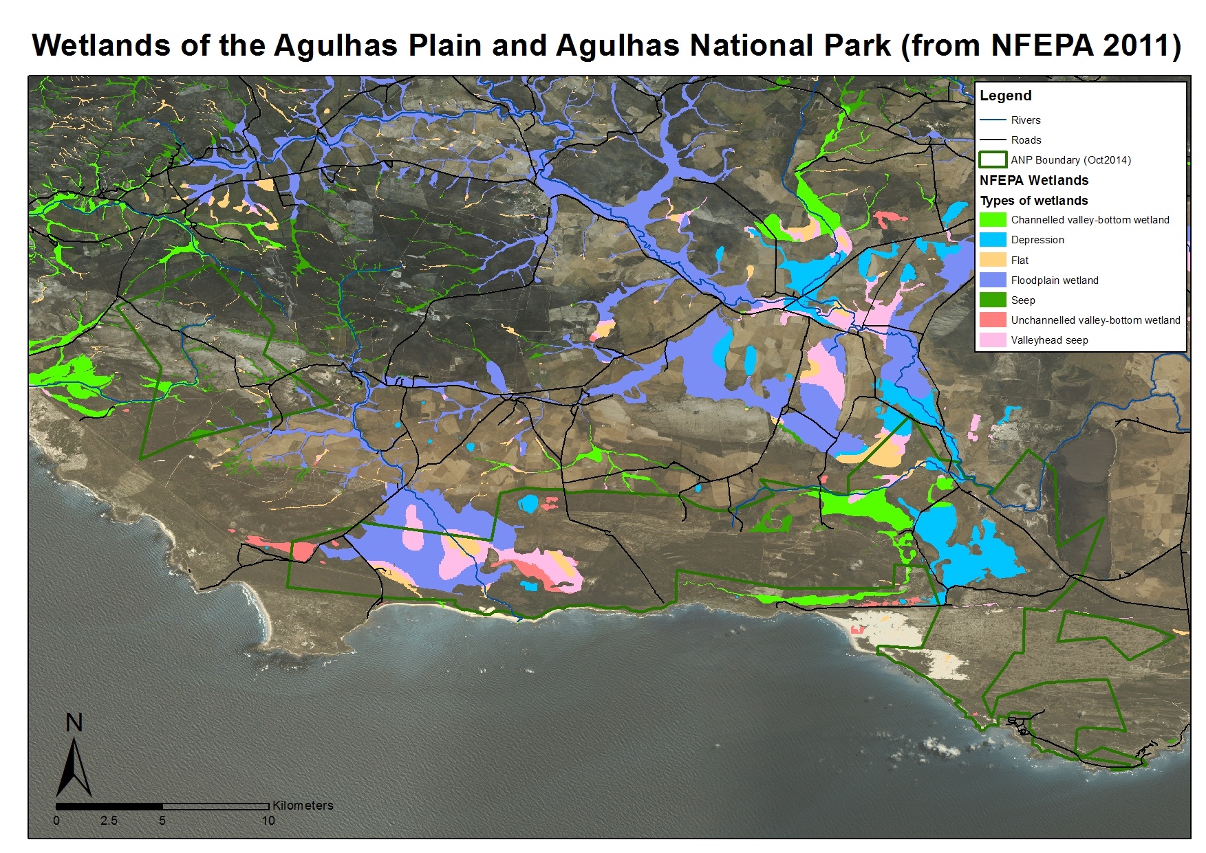
The National Freshwater Ecosystem Priority Areas (NFEPA) wetlands classification, produced in 2011. The map depicts the wetlands NFEPA classifies, based on a catchment drainage desktop-study (using a digital elevation model within GIS) as well as Hydrogeomorphic (HGM) Units set out by SANBI. Ruth-Mary Fisher is spearheading a project to verify and ground-truth this classification for Cape Cluster parks, starting with Agulhas NP and Tankwa Karoo NP.

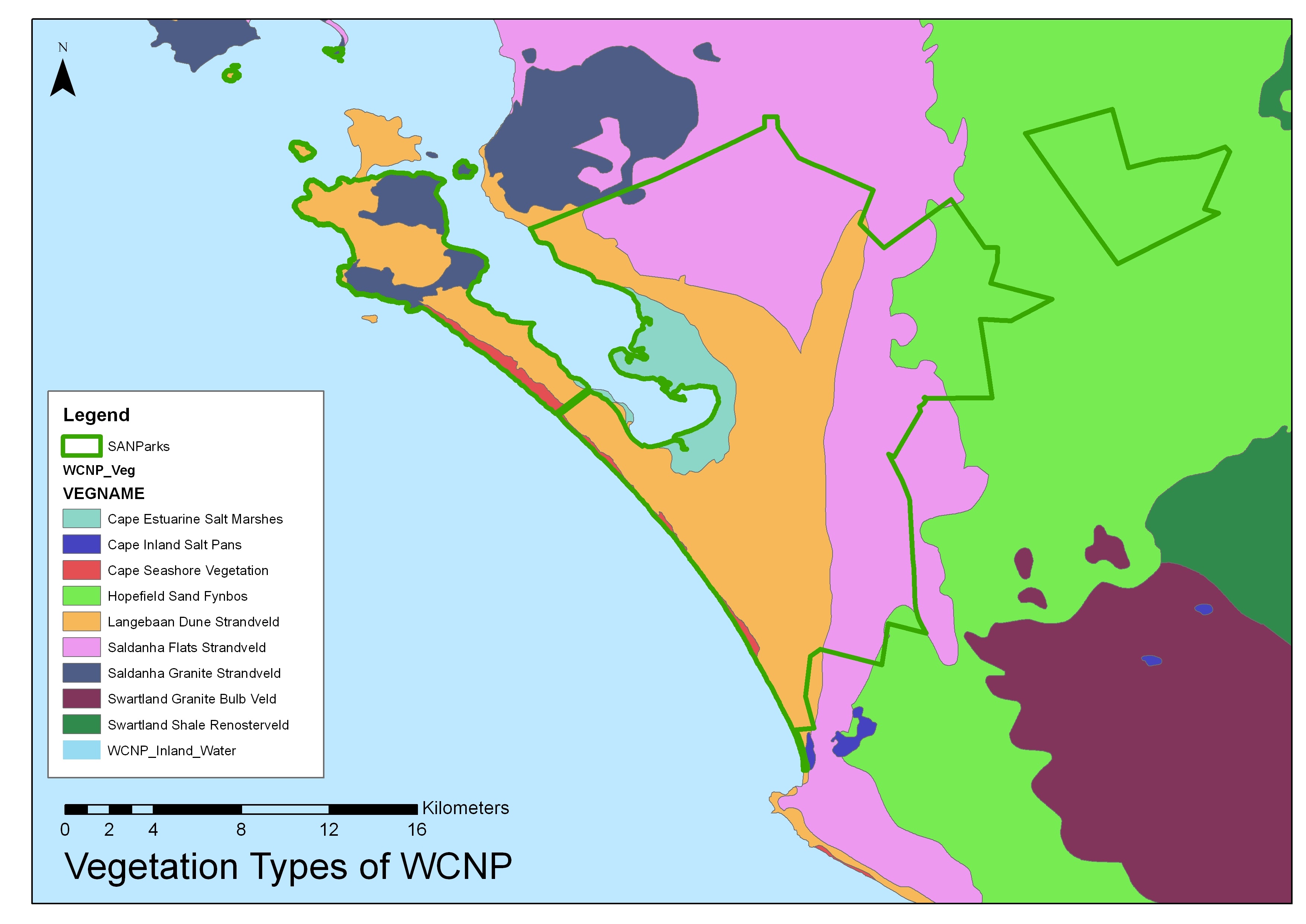
The map show the vegetation classification of Mucina and Rutherford (2006). This type of map is used as a reference when monitoring vegetation and when searching for Species of Special Concern.

The map show the vegetation classification of Mucina and Rutherford (2006). This type of map is used as a reference when monitoring vegetation and when searching for Species of Special Concern.
The map show the vegetation classification of Mucina and Rutherford (2006). This type of map is used as a reference when monitoring vegetation and when searching for Species of Special Concern.

The map show the vegetation classification of Mucina and Rutherford (2006). This type of map is used as a reference when monitoring vegetation and when searching for Species of Special Concern.
The map show the vegetation classification of Mucina and Rutherford (2006). This type of map is used as a reference when monitoring vegetation and when searching for Species of Special Concern.

The map depicts sites within West Coast NP and Saldana Bay which, in 1990, became Ramsar sites. These include the islands of Marcus, Malgas (Gannet), Jutten, as well as Langebaan Lagoon (including Schaapen lsland), and 16 Mile Beach.